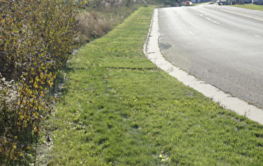
Infiltration facilities are a common and very useful means of regulating stormwater runoff, but the installations stand a relatively high chance of failure if they are improperly sited or monitored. U researchers developed tools to help designers and planners mitigate this problem.
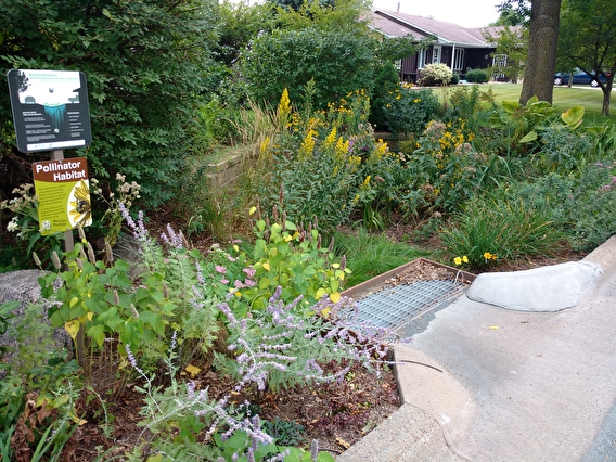
Any construction that involves one or more linear acres of impervious surfaces—including transportation and municipal engineering projects—is required by the Minnesota Pollution Control Agency to control and treat stormwater runoff. Infiltration facilities, which mimic the natural processes of infiltration and evapotranspiration, are the first choice that the MPCA prescribes to do this.
These infiltration facilities, however, have a high rate of failure—observed between 10 and 50 percent. This has two main causes: improper siting of the facilities and insufficient understanding of the site’s ability to infiltrate water (hydraulic conductivity).
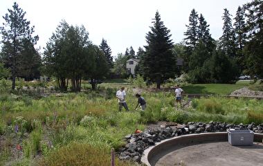
To address these issues, the researchers developed tools that make it easier for designers to select good sites, monitor the infiltration facilities over time, and ensure that they stay effective. The principal investigators for the project were Professor John Gulliver of the Department of Civil, Environmental, and Geo- Engineering and Professor John Nieber of the Department of Bioproducts and Biosystems Engineering.
Starting with a literature review, the researchers determined that there is a lack of standardization for the design and testing of infiltration facilities. In some states, for example, it is permissible to take only one hydraulic conductivity measurement for the entire site, even though soil is highly variable. (Up to three orders of magnitude of permeability have been observed within three feet.) Hydraulic conductivity is also commonly measured using soil texture, which has limited accuracy.
To help fill this information need, the researchers developed a rapid screening tool that designers can use to evaluate the potential suitability of an infiltration site. The tool uses a geographic information system (GIS) to compile existing data sets such as hydraulic conductivity, depth to groundwater, and elevation, which it uses to produce a “heat map” of the area’s infiltration potential.
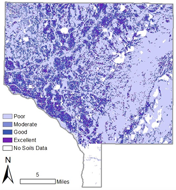
“The predesign selection tool leverages existing data to save designers time and effort,” says Dwayne Stenlund, erosion control specialist with MnDOT and technical liaison for the project. “They choose potential infiltration sites from their desks with a computer system rather than through multiple forays into the field.”
Additional data—such as MPCA maps of environmentally sensitive areas—can be layered onto the map as needed.
Soil can also become compacted during construction (which reduces infiltration capacity), Gulliver says, and facilities often lose effectiveness over their lifespan as the soil becomes compacted or clogged with sediment. The researchers aimed to develop a fast, accurate, and standardized protocol for measuring hydraulic conductivity throughout the construction and lifespan of the facility.
The research team conducted experiments that compared the accuracy and ease of use of common testing methods for hydraulic conductivity. The final report provides a summary of these different methods, guidelines on how to choose a method, and protocols for conducting the individual tests.
Both the rapid screening tool and the overall testing protocol have limitations, Gulliver notes. The screening tool is based on data sets that each have their own levels of uncertainty; soil and hydrologic data are highly variable, for example. The testing protocol has to strike a balance between the accuracy afforded by more tests and logistic feasibility.
Overall, however, Gulliver says that the project has the potential to mitigate flawed infiltration facilities, increase designer confidence in the practice, and provide a common framework for designers around the state.
The project was sponsored by the Minnesota Local Road Research Board and the Minnesota Department of Transportation.
Writer: Sophia Koch