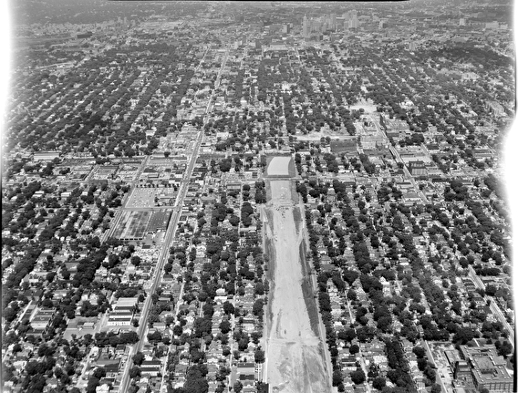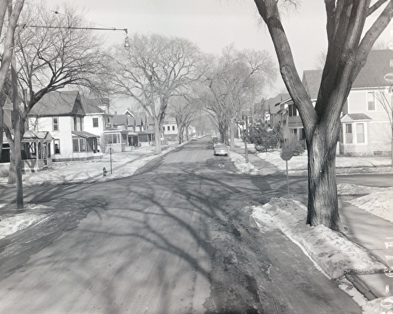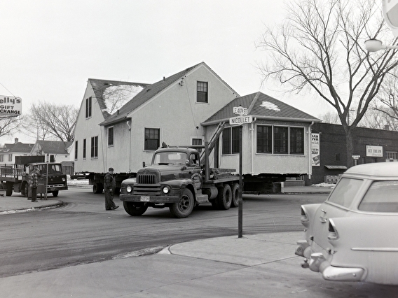
Many Minnesotans have driven on I-35W through Minneapolis without giving any thought to how the freeway was built—or the impact it’s had on the community. Thanks to the work of several U of M researchers and Twin Cities residents, we now have the opportunity to learn just that.
Human Toll: A Public History of 35W is an exhibit at the Hennepin History Museum that explores what happens when the construction of a freeway literally and figuratively tears apart a community.
While this exhibit focuses on the Minneapolis interstate, Ernest Lloyd (a retired MnDOT employee who wrote a pioneering doctoral dissertation upon which the exhibit is based) says it’s not unique. “If you map the locations of African American neighborhoods in any large or medium-sized city in the United States, a freeway runs through it or along the edge of it. This is true not only in the Twin Cities, but in L.A., Miami, New Orleans, Syracuse, Atlanta, and on and on and on.”
Indeed, under the leadership of President Dwight D. Eisenhower in 1956, the Interstate and Defense Highways Act allocated $25 billion for 41,000 miles of highways—shepherding in more than a decade of major road construction from coast to coast. These interstates allowed the primarily white residents living in America’s newly built suburbs to get places quickly and directly, but this increased mobility came at the cost of primarily Black communities.

Southside community elders told Lloyd that before the construction of I-35W in the 1960s, South Minneapolis was home to “an integrated neighborhood, a great place to raise a family,” Lloyd says. “There was a thriving commercial district and a Black middle-class community prior to construction of the freeway.”
While working on other community projects about the impacts of racial housing segregation, Human Toll project co-director Greg Donofrio, associate professor of Heritage Studies and Public History (HSPH) in the U of M’s School of Architecture, kept hearing from elders in South Minneapolis that they wanted to talk about the freeway.
Based on information Donofrio’s team gathered in these conversations, work on the Human Toll exhibit began in May of 2019 with students and faculty in the U of M’s HSPH program. Members of the community joined the team, and Lloyd came on as a research and community adviser and freeway history expert.
Through his dissertation research, Lloyd had learned that many residents didn’t know about the interstate’s construction until they saw bulldozers moving into their neighborhood. The Minnesota Department of Highways (MDH) held only one public meeting where people could learn about the project and voice their concerns—and the meeting notices were buried in the paper amidst classified ads, so they were easy to miss.
The larger research team discovered that the state acquired the land needed to build I-35W via condemnation, a legal process that allows governments to seize property needed for a public purpose. Black residents who were displaced had largely nowhere to go.
“Not only were their neighborhoods targeted and their houses destroyed,” says Donofrio, “but then there were few other places they could move due to restrictive covenants, redlining, and multiple forms of racial discrimination.”

For those who remained in the community, I-35W had been billed as a tree-lined parkway rather than the six-lane freeway that was actually built. Residents who lived next to the interstate were subjected to noise, air, and soil pollution that continues to this day.
As funds from the recently passed infrastructure bill begin to move into Minnesota, Lloyd says that “now is the time for policymakers to engage the communities directly impacted by transportation systems. There needs to be trustful community engagement with BIPOC, low-income, and poor communities regarding the planning, designing, and routing of freeway reconstruction around the Twin Cities.”
The Human Toll exhibit “gives us an opportunity to learn about what it meant to live in an integrated, healthy, and economically viable neighborhood,” says Lloyd. “It demonstrates the importance of how unresolved—indeed, unspoken—history lives in the heart and soul of families and transcends generations. This project is one step toward correcting past wrongs by acknowledging the past and building a better future.”
Human Toll: A Public History of 35W runs through October 1, 2022. Museum visitors can examine historical documents such as letters, photographs, newspaper clippings, and maps. Partners for the exhibit include the University of Minnesota HSPH program, MnDOT, and the Hennepin History Museum.
Photos courtesy of the Minnesota Historical Society.


