Road construction in northeast Minnesota often affects wetlands, and thus requires compensatory mitigation. Northeast Minnesota still retains more than 80 percent of its pre-European-settlement wetland acreage, so very few opportunities are available for traditional mitigation such as wetland restoration.
To determine whether abandoned “borrow pits”—areas that have been excavated for road construction materials—can be effectively converted to wetland for mitigation, researchers with the University of Minnesota Duluth Natural Resources Research Institute (NRRI) studied 14 wetland mitigation sites north of Virginia, Minnesota, along the U.S. Trunk Highway 53 reconstruction project corridor. The study was sponsored by the Minnesota Department of Transportation (MnDOT).
“Wetland creation—constructing wetlands in locations where they have not historically existed—generally gets a bad rap,” says Sarma Straumanis, MnDOT wetland program coordinator. “This poor reputation is driven by the failure of many wetland creations nationwide to live up to their performance standards.”
Abandoned “borrow” areas are one of the few remaining areas that can serve as wetland mitigation sites within the affected watersheds. “What we’ve seen is that the lack of long-term monitoring of mitigation sites is the primary reason for failure and non-compliance,” says Kurt Johnson, NRRI research fellow and principal investigator. “This project allowed us to continue the monitoring of two existing wetland demonstration sites that were created in 2007 for an additional four years and to monitor 12 new sites for four years.”
The new wetland sites were formed through the removal of borrow material for road construction. Next, salvaged peat and muck from several locations within the project corridor were applied. Finally, wetland seed mixes approved by Minnesota state agencies were applied to each site.
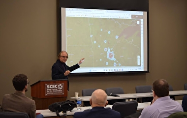
Researchers used several techniques to monitor progress. Water level wells were created at each site and monitored biweekly during the growing season. Two types of plant surveys were used to determine which types of vegetation were growing. During the first two years of the study, plant surveys were conducted at sample plots and the percentage of cover by each plant species was estimated based on the sample surveys. During the study’s final two years, researchers developed a new monitoring methodology to better quantify the quantity and quality of each wetland’s plant community using GPS mapping.
Monitoring results show that all but one of the sites consistently met wetland hydrology criteria, and that the 14 mitigation sites range in their potential to receive wetland mitigation credit. Researchers also outlined recommended steps for further improving the wetland sites.
“This research demonstrates that wetland creation can be successful given an appropriate landscape setting, an insightful design, an extended monitoring period—and favorable circumstances courtesy of Mother Nature,” Straumanis says.