Traffic modeling is an essential tool for transportation planners and organizations—models are used for everything from resource management to project scheduling and impact studies. Researchers at the U of M’s Minnesota Traffic Observatory (MTO) recently developed a highly complex traffic model of the entire Twin Cities metropolitan area. “In testing it,” says John Hourdos, the principal investigator, “we found that the Green Line light-rail transit line and the accompanying road and bus changes have increased road congestion on nearby roads, but not by much.”
In most cases, models are developed at a “macroscopic” level to include only the most basic information about the road network geometry and traffic patterns. However, when it comes to analyzing the impacts of specific improvements such as the Green Line corridor, these large-scale models can be insufficient.
“Macroscopic models often lack several key elements needed for the close examination of infrastructure and systems such as the Green Line light rail, which can result in errors for the estimation of things like travel speed and congestion delay,” says Hourdos, MTO director. “To address this gap and accurately gauge the impacts of the Green Line on the Twin Cities’ road network, we developed one of the most complex traffic simulations created to date.”
The large-scale simulation constructed by the research team was designed to capture localized, high-resolution data that incorporated accurate transit and signal information while maintaining a wide, regional scope sufficient to capture long-distance travel and dynamic rerouting. “This dynamic new modeling technique really gives us the best of both worlds,” Hourdos says. “It allows us to get a very detailed, microscopic view of the light-rail transit and immediately surrounding roads while integrating a higher-level view of the larger transportation network to study how changes affect the entire system.”

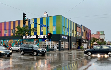
Green Line on streets such as Snelling Avenue.
The Green Line, which connects Minneapolis and St. Paul, opened for service on June 14, 2014. Findings from the new model indicate that I-94 absorbed most of the vehicle traffic diverting from University Avenue—which the Green Line runs along for most of its route—but freeway speeds were not significantly lowered. Neighboring roads were also affected, but the added traffic burden did not spread far from the LRT route. In addition, some parts of the Twin Cities metropolitan area, including downtown St. Paul, saw some improvement in congestion. For example, average speeds on downtown St. Paul streets increased by 10 to 15 percent during the afternoon peak period.
Along with valuable insights about the traffic impacts of the Twin Cities newest light-rail line, the ambitious scale of this project also breaks new ground in traffic modeling. Researchers found that while this type of large-scale integrated traffic model is time- and resource-intensive, it is possible. Using these new models, transportation planners will one day be able to gain more accurate information to aid decision making, particularly in large areas with complex traffic controls.
“The importance of John’s work becomes apparent when considered in the context of the corridors being studied for future transitways,” says Mark Filipi, manager of technical planning support with the Metropolitan Council. “Fiscal realities require that the efficient use of existing rights-of-way be maximized, with transit and automobiles sharing the corridor. This modeling technique will provide the region’s planners a new tool to fully assess the resulting joint use of a corridor.”
An important takeaway for transportation organizations, Hourdos notes, is that in order for this type of large-scale model to become widespread, agencies need to store, maintain, and share their modeling software and data.
The project was funded through the Transitway Impacts Research Program with financial support from the Minnesota Department of Transportation and the U’s Intelligent Transportation Systems Institute.